Post program I embarked on a week or so of travel with one of my closest friends from the program, Erin. At this time (if its not too late) I thought a map of Peru might prove useful for those who want to orient themselves. During the program I traveled to Ayacucho, the Cusco area, Paracas, Nasca, Ica, and Huaraz; all destinations in the southern half of the country. After final exams I flew even further south in order to visit Arequipa, Puno, and Colca Canyon. My friend and I had ganas to see a lot on a budget; we achieved both our goals and in doing so had many unplanned adventures.
Arequipa, also know as the white city, is Peru's second largest and second most important city. With a population of 3 million Arequipa is a sizable city by any standard; Peruvians like to joke that Arequipa is the Texas of Peru. Arequipeños consider their city to have a distinct culture (distinct enough, some say, to be considered its own country). The city has been the seat of several popular rebellions; as such, Arequipa is also known as "la heroica ciudad de los libros de Arequipa". Arequipa is famous for its colonial center, constructed out of volcanic sillar; for such dishes as: adobo, cuy chactado, chupe de camarones, ocopa, and rocoto relleno; and for being the birth place of the author Mario Vargas Llosa. Despite waves of recent immigrants from Puno the city has attempted to maintain its traditional European feel; in this, Arequipa has been mostly successful. To me Arequipa felt like a different country.
I spent two days alone in Arequipa while Erin was traveling with her family. It was a bit odd to be surrounded by tourists after months of just living, but I met a pretty chill, global crowd. Here are some highlights of my time spent in the white city:
Sunlight hitting the Cathedral in the Plaza de Armas.
I spent quite a bit of time here watching pigeons and Peruvians go about their daily business.
I felt like an urban Thoreau; sometimes you just have to while away the day watching ants.
Snapshots from el Monasterio de Santa Catalina: "Una ciudad dentro de la ciudad".
The Monastery of Saint Catherine was built in 1579 and later enlarged. At its peak it was home to about 450 people, the majority of these were Dominican nuns from upper class Spanish families. Today about 20 nuns live in the monastery; the proceeds from the entrance fee support the nuns and help to maintain the monastery. I met Erin in Puno; also known as the capital of Peruvian Folklore, Puno is located on the the Peruvian shore of Lake Titicaca. Peruvians like to joke about the etymology of the word Titicaca; apparently, the Peruvian side of the lake is known "titi" and the Bolivian side is known as "caca" (although Bolivians will tell you the opposite). However, the name is actually a combination of several words from both Quechua and Aymara (the local languages); it is often translated as "Rock Puma". Puno itself is not considered to be a tourist destination; it is a relatively poor and grubby town, even by Peruvians standards, and is home to many rural Peruvian immigrants looking for ways to improve their quality of life. Many foreign visitors use it as a "jumping off point" to explore the islands of Lake Titicaca. However, I found Puno to be fascinating in a gritty sort of way.
I made a Canadian friend (Claire) in Arequipa who happened to be traveling to Puno around the same time. We spent our first day together wandering through the Sunday farmer's market and unwittingly discovered an awesome park that included several playgrounds and a skate park. We whiled away the afternoon on a giant slide with a group of local children. The next day we boarded a collectivo in order to visit the Uros Islands and Taquile.
The Uros Islands are the famous made-made islands, constructed of reed, near the Peruvian shore of Lake Titicaca. They are pretty touristy, but certainly well worth a visit.
The three rubias: Clare, Erin, and I on the Uros Islands...and on the Island of Taquile.
Taquile is a beautiful island about 45k offshore of the city of Puno. The inhabitants of Taquile speak Quechua. The island is renowned for its textiles; knitting is a traditional activity performed exclusively by the men. As well as its innovative, community-controlled tourism; after tourists started to visit the island in the 70s, the islanders worked hard to control tourism for their own benefit.
Erin and I hamming it up on the way down to the harbor.
Sunset en route to Puno. Erin and I spent the long journey conversing in Portuspanglish with our fellow passengers: a Brazilian family and a Peruvian anthropologist doing field work on the Island of Amantani. We learned about Brazilian Politics: "There are more than thirty political parties, but really there are just two: los ladrones y los que no quieren más ladrones." Lake Titicaca is one of those magical places where the moon and the sun appear in the sky at the same time.

 The next day we hiked up to a Mirador (#urbanmountaineering) and drank in the view. Lake Titicaca, the highest navigable lake in the world and the largest lake by volume in South America, is truly an impressive site from above. I felt like I was on top of the world. Later, Erin and I took a mid-afternoon bus back to Arequipa. We enjoyed nutritious "alimentación a bordo" aka oreos and peanut butter while watching such quality films as: What to expect when you are expecting, The green lantern, and So undercover (don't laugh-I thought this was a judgement-free zone-and it was a long bus ride, ok?).

 The next day we hiked up to a Mirador (#urbanmountaineering) and drank in the view. Lake Titicaca, the highest navigable lake in the world and the largest lake by volume in South America, is truly an impressive site from above. I felt like I was on top of the world. Later, Erin and I took a mid-afternoon bus back to Arequipa. We enjoyed nutritious "alimentación a bordo" aka oreos and peanut butter while watching such quality films as: What to expect when you are expecting, The green lantern, and So undercover (don't laugh-I thought this was a judgement-free zone-and it was a long bus ride, ok?).
 The following morning Erin and I got creative on our way to Chivay (the largest and most important town in the Colca Valley). We arrived at the bus station around 7:30 am but the 8:00 am local bus was already full; there wasn't another bus until 11:00 am. So I marched over to the tourism office and inquired "si hay otra opción". Well, we ended up traveing with El Turismo Tico Tico. Now, don't let the name trick you into thinking that this is a transportation option designed for tourists because I can provide evidence to the contrary.

Erin and I traveled from Arequipa to Chivay in an overstuffed white van (with our backpacks strapped to the roof with a net) in the company of a bunch of locals. We actually stopped a couple of times before we left Arequipa in order to ensure that we were at max capacity. But hey, we got there and in what I am sure was record time.
The struggles continued in Chivay. The town is literally 9 blocks by 9 blocks. But somehow, no one seemed to have heard of our hostel; we had booked a double in Los Dos Lunas with "el servicio básico" before leaving Arequipa. Well, when we arrived at what we thought was the address (and by address I mean street name s/n-sin numero-that is) it appeared as if the ENTIRE street was under construction. After asking a few more villagers for directions we finally found the place; a full two blocks up from the original location. CLASSIC!
Afterwards Erin and I needed some serious relaxation. We took a collectivo to la Calera; a series of natural hot springs in the canyon that smell only vaguely of sulfur.
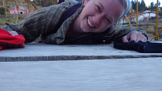
Just down the hill from the hot springs there is a bridge to the other side of the canyon. Erin and I fooled around on the bridge until we were asked to leave.
Left: Every pasaje of the market in Chivay is a reference to another location in Peru. Highlights include: Pasaje Polvos Azules (above) and Pasaje Gamarra (the clothing manufacturing neighborhood of La Victoria).
Right: The next day we discovered that "el servicio básico" included breakfast in bed.
Lunch (aka whatever was on hand): pancito, tuna verde (cactus fruit), gold fish, peanut butter, and peanuts. Accompanied by a read aloud from The Simarillion.
The next day we traveled with Turismo Milagro (again don't let the name fool you-the bus was essentially a mountain combi) to the famous Mirador del Cruz del Condor. Erin and I had lunch at the Mirador where we were fortunate enough to see 4 condors. After lunch we had to hike to Cabanaconde, the next town in the Valley, to catch a 2 pm bus. I noticed on the map that Cabanaconde appeared to be 12-14 km from the Mirador, but everyone we talked to said it was only about a 2 hr hike. Putting aside out trepidations we set out because, let's be honest, we really didn't have another option (save hitch hiking)...
Me and my churraniña-a doll that I bought to support the shelter we visited in Pampamarca.
After about an 1.5 hike we arrived at this sign (a tribute to Juanita, an Inca child sacrificed and buried near Cabanaconde, who I visited in el Mueso de los Santuarios Andinos in Arequipa) and we realized that we were only half way to Cabanaconde. Well after that, Erin and I hauled ass, ran through a several farmer's fields, and arrived in Cabanconde just in time to catch our bus (facturing in la hora peruana that is).
Erin and I spent our last day in Arequipa (her last day in Peru) straight chilling. We visited the San Camilo market (one of the cleanest and best organized markets I've seen in Peru), and shopped 'til we dropped in a used book store. We enjoyed a last supper at Chicha, Gastón Acurio's restaurant in Arequipa. The portions were enormous, the food amazing, and the company good. Below is a picture of my friend Catherine (la Morinita), who just happened to be in Arequipa at the same time, with a steaming portion of chupe de camorrones.


